Well Blogsters, my hands are calloused, my neck has a crick, my fingers are cracked and torn and, after being on a high for the last several hours, I am nearing exhaustion. But I finished the Dalton Highway to the Arctic Ocean and back!
For those who are wondering, this road has to be close to the Holy Grail for motorcyclists. It is a 1600 km round trip over roads that go from highway speed (tarred) to corrugation that rattles the teeth, to great rocks that threaten to topple you over at any moment. Most of it is somewhere in between those extremes. It took me four days. Some people ride it in two. I don’t know how.
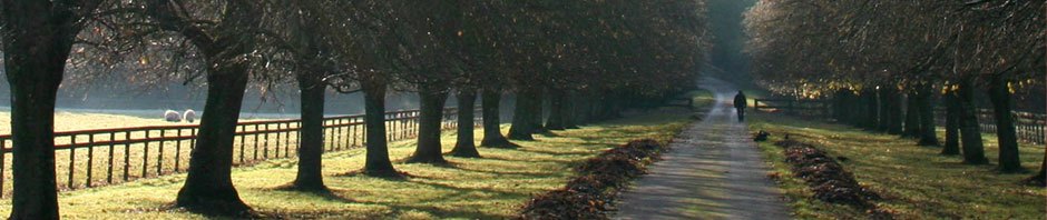
The highway begins around 120 kms north of Fairbanks, Alaska, and continues to Prudhoe Bay at the Arctic Ocean. The road was built for the oilfield at Prudhoe Bay, and follows a pipeline from Valdez, in the south of Alaska, to the Arctic. This is from Fairbanks to the halfway point, Coldfoot:

Fairbanks to Coldfoot
I set off on a Sunday morning. The weather forecast told me there would be clear skies for the following four days, so reckoned this would be my window of opportunity. Although it was cloudy when I left Fairbanks, I didn’t think rain was on the horizon so left the waterproof pants in the pannier. By the time I got to the start of the Dalton, 120 kms later, I was soaked! Decided now would be a good time to get the rain pants on, so I didn’t get any wetter.
Here’s a photo of the beginning of the highway:

Start of the Dalton Highway

Close-up of the sign
Immediately after these photos, the pavement ended and I was greeted with slippery mud and gravel for a good 80 kms. It was hairy. The rain pants were useless because I was already wet; the water had soaked down through my jeans and into my boots/socks. It was miserable and the rain showed no sign of letting up. My throttle hand was aching and the pain radiated up my arm. My neck and shoulders grew increasingly sore. The visor was up so I could see through the rain, equalling a wet, cold face. There was absolutely no way I was turning back!
I very gingerly, and in an extremely low gear, somehow navigated through all that slush until the rain stopped and the road went from slippery, dangerous mud to slippery, dangerously thick gravel. Slippery, dangerous mud is one thing, but slippery, dangerous mud on a steep downgrade is quite another. There were plenty of those. Not for the first time was I thankful I didn’t have the big yellow bag on the back.
The reason the road is more slippery than just dirt and water is because they coat it with calcium chloride, which supposedly keeps it compacted:

In addition, the road is built up high, meaning soft shoulders. It was a bit hair-raising when trucks came along, because you have to get right over to let them pass, but not too far over so a to topple off!

Soon the sun was out and with it my mood improved. I saw a lot of these on the way:

Arctic Ground Squirrel - can you spot it?
They stand on the side of the road, upright like Meerkat, then run across in front of vehicles. I didn’t hit any thankfully; all escaped me.
The first stop was Yukon River Crossing, which is just a truck stop really, with gas and a “motel”. I filled the tank as well as the 7 litre can I had brought with me. The gas stations up there are few and far between: nothing from the halfway point at Coldfoot until 400 kms later at Prudhoe Bay. Here is Yukon River Crossing, in case any of you want to visit some day:

Motel at Yukon River Crossing

Yukon River Crossing - not much there
After filling up I hit the road. There was not much to see at Yukon River Crossing, and Coldfoot, where I would stay the night, was still 192 kms away.
What do I think of when I’m riding these long distances? Lots of things when the road is good. I usually have some stupid song in my head, which I try unsuccessfully to lose. But when the road is bad, I am single-minded and there are two repetitive steps: quickly scan the road further ahead for obvious dangers like massive potholes, or boulder-sized rocks, then more carefully scan closer for dangers that weren’t immediately apparent. That’s all I do for what seems like hours on end. It gets emotionally tiring but is very necessary.
It is good to relax through the easier sections, and the parts that are sealed. However, those can be dangerous too. One of the many things that wreck roads in cold climates are frost heaves. This is not where the frost throws up, it’s more like the frost makes the road throw up. It is the result of ice under the road during the winter, so that the road becomes uneven, with dips and bumps. I found them quite difficult to spot on the sealed surfaces unless the sun was shining in the right direction. It’s a bit of a roller coaster ride if you hit any at speed.
Some of the road was good:

That oil pipeline is the one mentioned above, which sends the oil from Prudhoe Bay down to Valdez. Long way eh?
One of the points of interest on this part of the highway is Finger Rock, a few kilometres south of the Arctic Circle:

Finger Rock
Pilots in the early days used the rock as a navigation device, as the “finger” points directly to Fairbanks.
Soon after, one of the places I had been dreaming of crossing appeared on the horizon: the Arctic Circle! Here’s a photo:

Arctic Circle
It was a beautiful view but the mosquitoes nearly ate me alive. I didn’t stay long. Coldfoot was about 100 kms away and I was anxious to stop for the night.
Got into Coldfoot…hmmm. It is a truck stop, not a town. There are no towns up here, or even villages. All buildings, and collections of buildings, are there for a purpose, whether that be oil-related, trucker related, or to do with the road crews. They are basic and functional, rather than award winning architectural designs. Actually I don’t think architects, drafters, or designers had anything to do with any building north of Fairbanks to the Arctic Ocean. These are demountable buildings made of steel. Here’s the main building at Coldfoot. This is where you have meals, pay for gas, and do your laundry.

Coldfoot and Gas Pumps
Now, you are going to think my accommodation at Coldfoot, the Slate Creek Inn, was quite posh and luxurious, because it would have to be at $200 a night, right? One would at least have room service or even a personal butler at that price. Well, nup. None of that. It was…basic. I wasn’t complaining, it had a bed and a shower, all I needed, but…hmmm. Here’s an outside view:

Slate Creek Inn at Coldfoot
Guess you are wondering what it looks like inside eh? It looks like this:

$200 a night!!

$200 a night!!

$200 a night bathroom. Yes, that is chipboard.
Why are these rooms $200 a night? Because they can. They pretty much have an absolute monopoly up here. The owner told me the overheads are very high, which I guess is true considering the distance. However, I was tired and the room had everything I needed. I didn’t really care that it wasn’t the Hilton.
First thing to do was have a shower and wash off the road dirt. My clothes, by this stage, were not only wet (socks and boots) but muddy/dusty. So I showered and changed into my clean set of clothes, then headed off to eat something. Unhealthy, of course. No other choice up there but unhealthy. Oh well.
The food made me tired, and although I should have done my laundry I decided it could wait till morning, so got ready for bed. It was about 8 pm. I jumped in between the sheets and looked once more around the truly basic room. I reflected on the day’s ride, then drifted off into a sound and dreamless sleep…
…And woke two hours later. Could not get back to sleep. It was 10pm and the sun was shining brightly outside. Gave up with the slumber-quest and decided that now would be a good time to do some washing. Had some difficulty finding the laundry, as nothing is signed, but eventually discovered it to be a tumbledown shack out the back. There were weeds everywhere and general rubbish all over the ground. I hurried into the shack/laundry, hotly pursued by four hungry mosquitoes. Threw everything into the washer, then spent up to the rinse cycle in a stand-off with the mosquitoes. They were giving me the shits by that stage, so I declared war. I dispatched three of them by the time the spin cycle was done, and not without difficulty, I might add. Threw the clothes into the dryer, then spent a significant amount of time tracking down the fourth mosquito. He was a crafty little beggar. Despite my valiant efforts, he lived to see another day, so it ended up Janette 3, mozzies 1. I was reasonably happy with the score, but after all that exercise I was ready for bed.
The next day I faced with some trepidation. It was pretty much all dirt for the next 400 or so kms. I went for a coffee and something to eat. On the menu was, of course, sausages. Reindeer sausages. Yuk, and where do these people get off? I declined, and had eggs with sourdough toast and coffee.
Just north of Coldfoot was construction, lots of it. 40 kms of it. Thick dirt – a good 10 inches thick in places. Some of it had already been traversed by vehicles, and I wasn’t skilled enough to stay in their tracks, which meant a very scary and twisty ride. I got through it, but only because I am a praying person. I sent plenty up and they were answered. The same thing happened on the way back in a different place. The road consisted of huge fist-size rocks for quite a distance. I said my prayers and powered through, and miraculously was still upright by the end of it. Wish I could have taken a photo, but my hands were otherwise occupied. I can fair dinkum tell you the good Lord rode me through those foul sections, because there’s no way I’d ever have the skills. Worst road ever. I hope the Dempster Highway in the Yukon is better than this.
About 160 kms north of Coldfoot is Atigun Pass. This is part of the Brooks Range and is about 1400 metres high. The first third of the Coldfoot to Prudhoe Bay leg is mountainous, then the mountains give way to tundra. Here’s a map:

Coldfoot to Prudhoe Bay
This was beautiful, great mountain ranges so close it felt I could almost touch them. The hills begin:

Over the Atigun Pass:

And onward through the range…


There are only two things to see after the Brooks Ranges: permafrost and tundra. No more trees, not one. For you Aussies, tundra is tundra because of permafrost. Tundra exists because the dirt (permafrost) is frozen. Nothing grows on tundra except little shrubs, moss, etc. Walking on permafrost is an interesting experience. It’s kind of squishy, but not wet squishy. It’s more bouncy. I got this photo:

Permafrost + pathetic attempt at being creative
I loved the tundra. The tundra is this great expanse of absolutely nothing. I stopped from time to time to listen to the silence, the nothingness of it all. In our day to day world, and the environment in which we live, silence is something we do not experience and indeed cannot. There is always some measure of noise: cars, people, television, a cacophony of sound that invades our senses to the point where we forget what peace there is in silence. More than that, our environment consists of not only sound but constant movement. To stand still in a place where nothing moves, and there is no sound, gave me a most serene sense of contentment. Here are some pics of the tundra; hopefully, to some degree, they will reflect what I am trying to say:

Tundra

More tundra
By this stage the road was absolutely disgusting, gravelly and corrugated for the last 120 kms to Prudhoe Bay. It just seemed never-ending, and I constantly counted down the kms to go. They had wet quite a long section of this part of the road, so it was slippery as well. Here is a pic with some animals, it also shows the state of the road, however the photo lies – the road was much worse than this!

Another pic of the road. Again, it does not clearly show just how bad it was:

Saw some Caribou crossing the road:

It was getting colder, too. Here is a pic where there is quite a bit of ice still lying about. This is not far from Prudhoe Bay:
 I was originally going to tell you all about the Dalton Highway trip in one go. However, this post is turning into War and Peace, so I will end it here. Stay tuned for Prudhoe Bay, the Arctic Caribou Inn, where I stayed the night, and my swim in the Arctic Ocean…


Well done ! What more can I say ? Only you could survive that, …. on a bike ! Let’s hope for better roads from here on. WELL DONE !
Better roads…hmmm. I have the Top of the World and Dempster Highways coming up. The Dalton was certainly a good training ground!
Holy love a duck. You are a plucky one. I’m just glad that you have made it back into civilization! Sore I’m sure but safe!!!
Bravo!
Yes – butt is still sore after three days!
saw a documentary recently bout most dangerous roads in world. dalton highway right up there.looked terrifying on film with those monster trucks coming at ya.